Question: Where exactly is the Old Tōkaidō in Tokyo’s Shinagawa, and how do you walk it without being pulled onto a modern highway? Answer: Start at Keikyu’s Kita-Shinagawa Station and follow the signed “Kyu-Tōkaidō” back street south through Kita-Shinagawa and Minami-Shinagawa toward Aomono-Yokocho. The route is a modest, lived-in street with wayfinding posts and neighborhood maps. Plan about an hour at an unhurried pace, expect bicycles and delivery trucks, and remember it’s first and foremost a residential road.
This is not a museum piece behind ropes. It’s an everyday street where the first post town out of Edo—Shinagawa-shuku—once stretched along the bay. Much has changed; much has been paved, rebuilt, and wired. Yet the line of the old road still threads through the neighborhood, and there’s enough left to read the story of early travel if you slow down.
Finding the Old Tōkaidō in Shinagawa
Two simple entry points make the walk straightforward. The most intuitive is Keikyu’s Kita-Shinagawa Station. From the ticket gates, step into the street grid and look for brown or wooden-toned posts, sidewalk plaques, or neighborhood maps labeled with 旧東海道 (Kyu-Tōkaidō). The old road runs parallel to the busy Daiichi-Keihin (National Route 15) but sits one block inland, where the traffic thins and shopfronts face a narrower carriageway.
The second entry point is Keikyu’s Aomono-Yokocho Station. From here, you can walk north along the same signed street through Minami-Shinagawa to Kita-Shinagawa. Either direction works; the route is compact and linear, and you’ll find small confirmation signs at corners and crossings.
Digital maps sometimes mark “Kyu-Tokaido” or “Old Tokaido” segments, but not always consistently. Local signage and neighborhood maps do more reliable work on the ground. Expect the path to dogleg around modern blocks; when it does, watch for route arrows and street-name plates that include saka (slope) or bridge references—lingering clues to the old road’s shape and the waterways it once paralleled.
What to Notice on This Ordinary Street
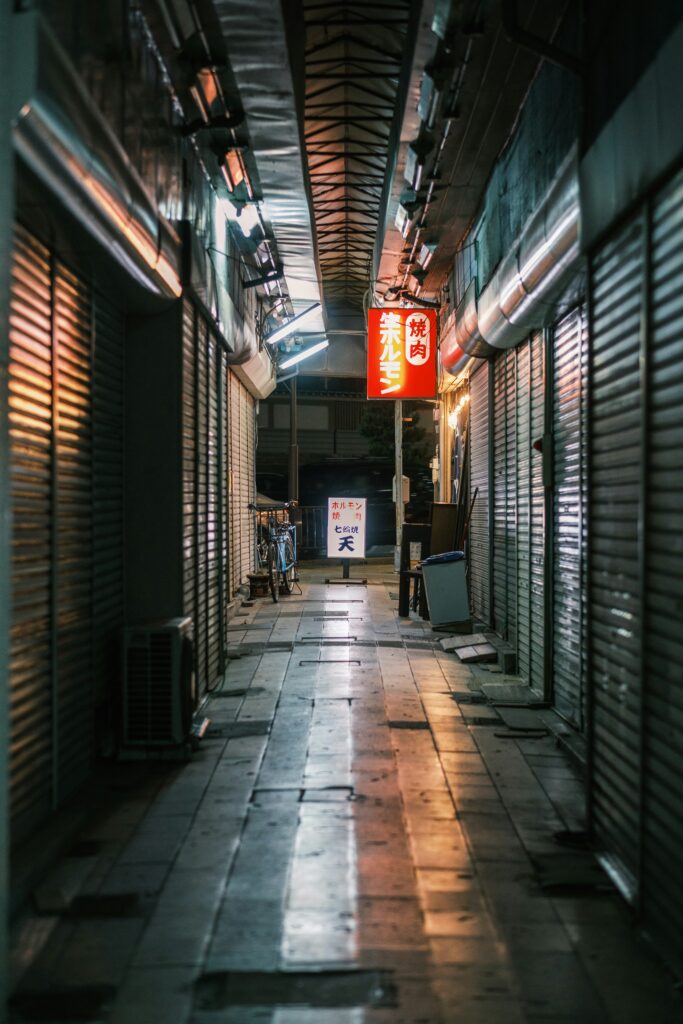
What’s left is fragmentary but telling. Storehouses rebuilt in concrete mimic old volumes; a temple gate holds the line of the road; narrow side lanes open like ribs, hinting at the inn yards and side alleys that gave a post town its bustle. Some corners keep small stone markers, explanatory plaques, or replicas of older signposts. Temple precincts appear without announcement, often behind low walls and clipped hedges. Everyday shutters form a plain façade by day, then drop at closing to reveal hand-painted shop names or neighborhood mascots—contemporary echoes of signboards that once advertised lodging, tea, or sake.
Look down as much as forward. Brass street studs, different paving textures, and the occasional curb stone with rounded wear can read like annotations. Street names that end with -saka (hill) note former rises—important in a coastal district where even a small slope once mattered for drainage. And here and there, a weathered milepost-style marker will nod to a much larger network of distances. For context on those measurements and the old road system’s logic, see Tracing Edo’s Lost Mile Markers: The Quiet Story of Japan’s Ichirizuka.
None of this demands reverence. It invites attention. The more modest the trace, the more it rewards patience: a handrail patched three times, a rain chain over a tight eave, a shrine the size of a lunch box set against a block’s granite foundation.
Why Shinagawa Mattered: First Steps Out of Edo
During the Edo period, official travel and private journeys followed shogunate-regulated highways linking the capital with regional domains and other major cities. The most trafficked route was the Tōkaidō, running along the Pacific coast between Edo (Tokyo) and Kyoto. Leaving from Nihonbashi, travelers reached their first post town—Shinagawa-shuku—within the day. Here they could rest, eat, and arrange lodging before continuing south toward Kawasaki, Kanagawa, and beyond.
Post towns were logistical machines as much as places on a map. They balanced the needs of officials on sankin-kōtai (alternate attendance) with those of merchants, pilgrims, and porters. Distances were standardized; horses and palanquins were regulated; checkpoints recorded traffic. Shinagawa’s role near the capital made it sensitive to policy shifts, but also energetic: a threshold where the vast apparatus of Edo ended and the open road began. Even if the seafront has been reclaimed and the entertainment quarters absorbed into a modern district, the long line of that street still holds the memory of departure.
Walking Gently on a Lived-In Road
Respect is practical here. This is a functioning neighborhood—kids on bikes, grandparents with carts, trucks pulling to the curb. Treat the Old Tōkaidō like the front room of many houses, because it is.
- Walk single-file on narrow stretches; give way to bicycles and delivery vehicles.
- Keep voices low near open windows and in front of small shrines or temple gates.
- Ask before photographing identifiable people, and avoid pointing cameras straight into private entryways.
- Buy small things if you step inside a shop; don’t block doors or counters while browsing.
- Carry out any trash. Local waste points are for residents and follow strict schedules and sorting rules.
Many shops in older districts close on fixed weekly rest days, a practice known as teikyūbi. If the street feels especially quiet and shutters are down, you may have hit one. Planning around that pattern helps: see Reading Teikyūbi: Japan’s Quiet ‘Closed Days’ and How to Plan Around Them for a primer on how these cycles work.
A Simple Route to Follow
Northbound: Aomono-Yokocho to Kita-Shinagawa
From Keikyu Aomono-Yokocho Station, exit to ground level and pick up the signed Kyu-Tōkaidō heading north. The street settles into a steady rhythm of small shops, homes, and occasional temple fronts. When the route jogs around modern blocks, wayfinding signs help you wrap back onto the line. Continue into Minami-Shinagawa and then Kita-Shinagawa, where the concentration of plaques and posts tends to increase. The walk is short enough to linger: pausing at a corner map, reading a bilingual panel, stepping aside to let a courier pass.
Southbound: Kita-Shinagawa to Aomono-Yokocho
From Keikyu Kita-Shinagawa Station, find the first Kyu-Tōkaidō marker and move south through the old post town’s spine. The street narrows and widens in places, reflecting how properties were once divided. Keep habitually to the edge; bicycles will often materialize quietly. When you meet larger crossings, confirmation signs usually sit just across the intersection so you can pick up the thread. Ending at Aomono-Yokocho gives quick train access again, or you can continue farther toward Oi if time and weather allow.
Getting There, Timing, and Orientation
Keikyu Line trains connect smoothly to both suggested starting stations: Kita-Shinagawa and Aomono-Yokocho. Shinagawa Station on JR lines sits a short walk west of parts of the route, though the larger roads between can be distracting. If arriving from central Tokyo on the JR Yamanote Line, transferring to the Keikyu at Shinagawa or simply walking east and dropping into the quieter grid is feasible. The old road sits just inland from the main thoroughfare (Route 15), so it’s easy to confirm you’re parallel to it if you feel turned around.
The Old Tōkaidō here works as a morning or late-afternoon stroll. Weekday mornings bring shopkeepers opening shutters and students on uniformed commutes; mid-afternoons can feel particularly calm. Rain changes the soundscape and slows traffic, making reading plaques or noticing gutters and rooflines easier. If your aim is to browse small businesses, watch for those weekly closed days and standard mid-day breaks.
Allow about an hour for the core street, plus time for any detours into temples or small shops that welcome visitors. Surfaces are mostly flat, with some narrow sidewalks and occasional gentle slopes. Wheelchair users or travelers with strollers will find sections comfortable and others tight; patience and scanning ahead for curb cuts help.
The line of the Old Tōkaidō continues south in fragments—toward Oimachi and Omori, across ward boundaries, into Kawasaki and Kanagawa—where signage thins and traffic grows, but the same clues guide you: posts, -saka street names, the odd historical plaque. Think of Shinagawa as a readable chapter rather than the whole book.
Every city holds routes like this under the surface. In Tokyo, they reveal how thoroughly premodern patterns still steer modern life. A post town once managed arrivals and departures; today the same corridor hosts parcel vans and commuters. The present keeps folding itself over the past, yet the fold is never perfectly smooth. On the Old Tōkaidō in Shinagawa, that crease is a street you can walk.